
Navigating the vast oceans and unknown territories of ancient times would have been an incredibly daunting task, one that required skill, knowledge, and the ability to harness the power of the celestial bodies above. Through the meticulous observation of the sun, stars, moon, and planets, ancient seafarers and explorers were able to develop sophisticated navigation techniques that enabled them to traverse the seas and chart new territories. These celestial observations not only provided invaluable information for determining latitude and longitude but also played a crucial role in calculating time, distance, and avoiding hazards. In this article, we will explore the profound impact that celestial observations had on navigation in ancient times and how these early navigational techniques continue to inspire and influence modern-day methods. So, let us embark on a journey through the skies and unravel the mysteries of celestial navigation.
The Importance of Navigation in Ancient Times
Navigating the vast oceans and unknown territories of ancient times was of paramount importance for various civilizations. Whether it was for trade, exploration, or conquest, the ability to navigate accurately and efficiently allowed ancient societies to expand their reach and establish connections with distant lands. The importance of navigation in ancient times cannot be overstated, as it shaped the course of history and facilitated the exchange of goods, ideas, and knowledge between different cultures.
In ancient times, maritime trade routes flourished, enabling the transportation of valuable commodities such as spices, silk, and precious metals. For civilizations like the Phoenicians, Egyptians, Greeks, and Romans, navigation was crucial for economic prosperity and maintaining political dominance. These ancient seafarers ventured into uncharted waters, relying on their navigational skills and celestial observations to guide them safely to their destinations. By understanding the movements of the stars and the position of celestial bodies, sailors could determine their location relative to specific landmarks or known trade routes.
Navigation played a pivotal role in exploration and the discovery of new lands. Ancient explorers, such as the Vikings and Chinese sailors, embarked on perilous journeys to uncover new territories, seek resources, and establish trade networks. Without accurate navigation, these intrepid adventurers would have been unable to navigate the treacherous seas or find their way back home.
The importance of navigation extended beyond trade and exploration. In ancient warfare, naval superiority was often the deciding factor. Empires like the Athenians and Persians heavily relied on their naval fleets to secure their territories and project power. Effective navigation enabled these ancient navies to strategize and execute military campaigns with precision, ensuring the success of their expeditions.
It is crucial to recognize that navigation in ancient times was not limited to seafaring alone. Land exploration and trade caravans also required skilled navigators who could traverse vast deserts, dense forests, and inhospitable terrains. Ancient civilizations, such as the Incas, Mayans, and Silk Road traders, developed their own navigation systems adapted to their specific geographic challenges.
The importance of navigation in ancient times cannot be understated. It was a vital skill that enabled civilizations to expand, explore, trade, and exert dominance over their rivals. Through the mastery of celestial observations and the development of navigational techniques, ancient seafarers and explorers shaped the course of history and paved the way for future discoveries. The legacy of ancient navigational practices continues to influence and inspire modern-day navigation methods, reminding us of the remarkable achievements of our ancestors in unraveling the mysteries of the great unknown.
Ancient Celestial Observations

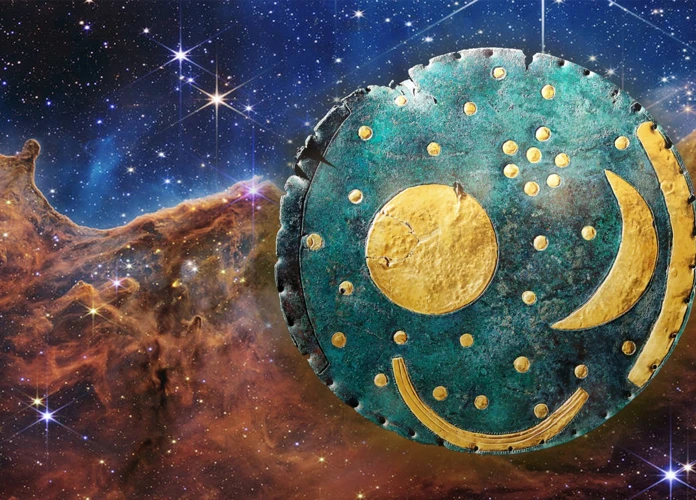
Ancient civilizations from around the world were keen observers of the celestial bodies above, recognizing the profound impact they had on their lives and their navigation systems. The study of ancient celestial observations reveals the rich knowledge and understanding these civilizations possessed. Early observations of the sun and stars allowed ancient seafarers and explorers to determine direction and approximate location. Tracking the moon’s phases provided them with a reliable way to measure time and understand the tides. Navigating with planets, such as Venus and the Pole Star, helped them establish fixed landmarks and reliable reference points for their journeys. These celestial observations not only influenced navigation but also played a crucial role in the development of astrology, alchemy, and mythology. The ancient seafarers and astronomers understood the intricate relationship between the celestial realm and the earthly domain, fostering a deep spiritual connection with the cosmos. Studying the ancient celestial observations allows us to appreciate the wisdom and ingenuity of our ancestors and provides insights into the intersection of science, spirituality, and exploration in ancient times. For more on the historical perspective of astrology, you can visit /astrology-alchemy-renaissance/.

1. Early Observations of the Sun and Stars
Early observations of the sun and stars formed the foundation for celestial navigation in ancient times. Civilizations such as the Egyptians, Mesopotamians, and Greeks recognized the significance of these celestial bodies in understanding their position on Earth and navigating across vast distances. The sun, being the most prominent celestial object, served as a crucial reference point for determining direction and time of day. Ancient seafarers noticed that the position of the sun at noon varied depending on their location, allowing them to estimate their latitude and approximate their distance from the equator.
Additionally, the stars played an instrumental role in navigation. The ancient Greeks, for example, observed constellations and their movements throughout the night to navigate. One of the most important constellations for navigation was the Big Dipper, or Ursa Major, which was used as a guiding star that always pointed towards the North Star. By identifying the North Star, sailors could determine their latitude in the northern hemisphere, facilitating navigation along established trade routes.
Early observations of the sun and stars led to the development of rudimentary instruments and techniques to aid navigation. The Egyptians used a tool called the merkhet, which consisted of a narrow wooden plank with a plumb line, to measure the angle of celestial bodies accurately. This allowed them to determine the time of day and track the sun’s movement across the sky.
The ancient Greeks developed the armillary sphere, a complex celestial globe with rings representing celestial equator, ecliptic, and other important reference lines. This instrument enabled navigators to visualize the positions of stars and planets, making it easier to identify and track them during their journeys.
Early observations of the sun and stars not only provided practical benefits for navigation but also held significant cultural and mythological significance. Many ancient civilizations believed that the movements of celestial bodies were closely linked to the gods and had mystical interpretations. These beliefs influenced the development of astrology, which sought to understand and interpret the impact of celestial events on human lives. The study of astronomy also flourished in tandem, with ancient astronomers making noteworthy observations of astronomical events and contributing to our understanding of the cosmos.
Early observations of the sun and stars laid the groundwork for celestial navigation in ancient times. The recognition of the sun’s position and the movements of stars provided essential information for determining direction, latitude, and time. These observations led to the development of instruments and techniques that aided navigators in their journeys across land and sea. The cultural and mythological significance attributed to celestial bodies inspired further exploration and study of astronomy and astrology. The impact of early sun and star observations on navigation in ancient times cannot be undermined, as they formed the basis for the development of future navigation tools and techniques.
2. Tracking the Moon’s Phases
Tracking the moon’s phases was an essential aspect of celestial observations in ancient times. Ancient civilizations recognized the cyclical nature of the moon’s appearance and disappearance, and they harnessed this knowledge to aid in navigation. By observing and interpreting the moon’s phases, navigators were able to determine the time of month and approximate their location.
One of the primary uses of tracking the moon’s phases was for calculating time during nighttime navigation. Ancient seafarers and land travelers relied on the moon as a natural timepiece. By observing the moon and its phases, they could estimate the time of night and adjust their course accordingly. This was particularly important in regions where landmarks or other navigational aids were scarce or unreliable.
Tracking the moon’s phases provided valuable information about tides and currents. The gravitational pull of the moon influences the ebb and flow of the tides, and understanding this phenomenon was crucial for safe navigation. Ancient sailors used their knowledge of the moon’s phases to predict high and low tides, allowing them to navigate shallow waters and avoid running aground. By aligning their voyages with the lunar cycle, they could take advantage of favorable tidal conditions and optimize their travel.
The moon’s phases also played a vital role in determining the start of months and seasons. Many ancient calendars were based on lunar cycles, with each month beginning at the new moon. By tracking the moon’s phases, civilizations could determine when to plant crops, organize religious festivals, and schedule important events. The moon’s phases provided a framework for timekeeping and helped establish a sense of order and rhythm in ancient societies.
In addition to its practical applications, the moon’s phases carried symbolic and cultural significance for many ancient civilizations. The waxing and waning of the moon were often associated with rebirth, cycles of life, and the divine. Ancient mythologies and belief systems often incorporated lunar symbolism, assigning mystical qualities to different phases of the moon. These cultural perspectives further enriched the understanding and interpretation of the moon’s phases in relation to navigation and life in general.
Tracking the moon’s phases was a critical component of celestial observations in ancient times. It allowed navigators to determine the time, predict tides, and establish a rhythm for daily life. By harnessing the power of the moon, ancient seafarers and land travelers were able to navigate with greater precision and confidence, contributing to their successful explorations and journeys across vast distances. The knowledge gained from tracking the moon’s phases continues to be influential in modern navigation practices, showcasing the enduring legacy of ancient celestial observations.
3. Navigating with Planets: Venus and the Pole Star
Ancient navigators found great value in observing specific celestial bodies, such as the planet Venus and the Pole Star, as they provided vital information for determining direction and position during voyages. Venus, often referred to as the “Morning Star” or the “Evening Star,” was particularly significant due to its brightness and conspicuous presence in the sky. As one of the most easily visible celestial objects, Venus served as a reliable reference point for sailors.
By observing the position of Venus in relation to the rising or setting sun, ancient mariners could gauge their direction of travel. When Venus appeared in the morning sky just before sunrise, it indicated an easterly direction. Conversely, when Venus appeared in the evening sky just after sunset, it signaled a westerly direction. This simple yet effective method allowed navigators to maintain a general sense of their east-west position, aiding in course corrections and helping them stay on track.
The Pole Star, also known as Polaris, was another crucial celestial reference point for navigation. Located close to the earth’s celestial North Pole, the Pole Star remained almost fixed in the northern sky, unlike other stars that appeared to move throughout the night due to the earth’s rotation. This stability made it an invaluable tool for determining latitude.
Ancient mariners could determine their latitude by measuring the angle between the horizon and the Pole Star. As they traveled north or south, the elevation of the Pole Star would change accordingly. By comparing the angle they measured with known values, navigators could estimate their position relative to the equator.
Navigating with Venus and the Pole Star required a deep understanding of celestial movements and precise observational skills. Ancient sailors relied on their knowledge of these celestial bodies to guide them safely across vast distances, ensuring that they stayed on course and reached their intended destinations.
The influence of celestial observations, including those involving Venus and the Pole Star, demonstrates the remarkable ingenuity of ancient navigators. These techniques continue to be honored and studied today, reminding us of the profound impact that celestial bodies have had on human exploration and navigation throughout history.
The Influence of Celestial Observations on Navigation
The influence of celestial observations on navigation in ancient times cannot be overstated. By closely studying the movements of the sun, stars, moon, and planets, ancient seafarers and explorers were able to harness the power of the celestial bodies to navigate the vast oceans and chart their course. Celestial observations played a pivotal role in determining latitude and longitude, allowing sailors to precisely calculate their position relative to known landmarks or trade routes. This knowledge was essential for early explorers to navigate safely and reach their desired destinations. Additionally, celestial observations provided crucial information for calculating time and distance, enabling sailors to plan their voyages and estimate their arrival times. Understanding the positions and patterns of celestial bodies helped seafarers to avoid potential hazards, such as reefs or treacherous currents, and discover new lands or trade routes. The influence of celestial observations on navigation was not limited to seafaring alone. Land-based navigators also relied on celestial observations to traverse vast terrains, such as deserts or dense forests. The legacy of ancient celestial navigation continues to inspire modern-day navigation methods, reminding us of the remarkable ingenuity and resourcefulness of our ancestors in navigating the vast unknown.
1. Determining Latitude and Longitude
Determining latitude and longitude was a crucial aspect of celestial navigation in ancient times. By understanding how to measure these coordinates, sailors and explorers could accurately determine their position on the Earth’s surface, allowing them to navigate with precision.
Latitude, which measures the distance north or south of the equator, could be determined through the observation of celestial bodies such as the Sun or specific stars. Ancient navigators would measure the angle between the celestial body and the horizon using instruments like the astrolabe or quadrant. By comparing this angle to a reference table, they could estimate their latitude with a reasonable degree of accuracy. This knowledge of latitude was particularly vital for identifying the general location of a ship or landmass.
Longitude, on the other hand, posed a greater challenge for ancient navigators. Unlike latitude, which could be determined by observing the position of celestial bodies, measuring longitude required accurate timing. Ancient sailors relied on tools such as sundials or water clocks to keep track of time. However, these timekeeping devices were far from perfect and were susceptible to errors due to fluctuations in the length of a day.
It was not until the invention of the marine chronometer in the 18th century that accurate longitude measurements became possible. However, in ancient times, sailors developed various techniques to estimate their longitude, albeit with limited accuracy. One such method involved comparing local time, determined using the position of the Sun or stars, with an established reference time, such as the time at a known port. The time difference between the two locations would give an estimate of the ship’s longitude.
While ancient navigators faced challenges in accurately determining longitude, their understanding of latitude allowed them to navigate vast distances and explore new territories. By combining their knowledge of celestial observations, timekeeping, and navigational techniques, ancient sailors were able to traverse the seas, navigate trade routes, and make remarkable discoveries.
The ability to determine latitude and longitude through celestial observations revolutionized navigation in ancient times. It provided sailors with a vital tool for charting their course and reaching their desired destinations. The influence of these early navigational methods can still be seen today in modern navigation systems, serving as a reminder of the ingenuity and resourcefulness of ancient navigators who relied on the stars and their surroundings to navigate the vast unknown.
2. Calculating Time and Distance
Calculating time and distance accurately was a crucial aspect of navigation in ancient times. Navigators relied on celestial observations to determine their position, track their progress, and estimate the time it would take to reach their destination. By understanding the movements of the celestial bodies, ancient seafarers could develop methods for measuring time and distance with a significant degree of precision.
One of the primary tools used for calculating time was the sun. By observing the position of the sun in the sky at different times of the day, sailors could estimate the time and make adjustments to their course accordingly. For example, by measuring the angle between the horizon and the sun using a quadrant or astrolabe, navigators could determine if it was morning, noon, or afternoon. This information allowed them to keep track of time and make necessary adjustments to their navigation plan.
Distance calculation was equally important for ancient navigators. They needed to estimate the distance traveled, as well as the distance remaining to their destination. One method used was dead reckoning, which relied on measurements taken from landmarks, such as cliffs, mountains, or specific formations along the coast. By noting the time it took to pass these landmarks and estimating their distance, navigators could calculate their speed and approximate the remaining distance to their destination.
Another method used to calculate distance was celestial navigation. By measuring the angle between specific stars or constellations and the horizon, sailors could determine their latitude. This information, coupled with the knowledge of the earth’s circumference, allowed them to calculate the distance traveled. Celestial navigation also played a crucial role in determining longitude. However, accurate longitude calculations were more challenging and required advanced tools and techniques, which were not available in ancient times.
Calculating time and distance was a complex task for ancient navigators. It required a deep understanding of celestial observations, mathematics, and the ability to interpret and apply the gathered data. The accuracy of these calculations heavily relied on the navigators’ skills and the reliability of their instruments. Nonetheless, the ability to calculate time and distance allowed ancient sailors to plan their journeys effectively, make necessary adjustments, and reach their intended destinations with a remarkable level of precision.
The relationship between celestial observations, time, and distance in ancient navigation highlights the intricate connection between astronomy and the ancient art of navigation. The understanding of astronomical events and their impact on navigation permeated various aspects of ancient cultures. From mythological interpretations of celestial phenomena to the development of precise measurement techniques, the celestial realm played a significant role in guiding ancient seafarers on their voyages of discovery. Today, we can see glimpses of this close connection in the way celestial events continue to influence our calendars, zodiac signs, and cultural practices, providing us with a glimpse into the vast history of celestial navigation.
3. Avoiding Hazards and Discovering New Lands
Ancient navigators relied on celestial observations not only for determining their position and direction but also for avoiding potential hazards and discovering new lands. The ability to navigate safely through treacherous waters was essential for the survival and success of ancient seafarers. By studying the movements of the stars, moon, and planets, sailors could identify dangerous areas such as reefs, shoals, and rocky coastlines. They could also navigate around unpredictable weather patterns, such as storms and hurricanes, by analyzing cloud formations and wind direction. The knowledge gained from celestial observations allowed sailors to chart safer routes and avoid potential shipwrecks.
Celestial observations played a crucial role in the discovery of new lands. Ancient explorers sought to expand their horizons and find unexplored territories for various reasons, such as resources, trade opportunities, or curiosity. By using celestial navigation techniques, such as tracking the position of stars and planets, sailors could venture into uncharted waters with greater confidence. The ability to navigate accurately enabled them to reach distant lands that were previously unknown to their civilizations.
One notable example of this is the story of Christopher Columbus. By studying ancient texts and astronomical charts, Columbus believed he could reach the Indies by sailing westward. His understanding of celestial navigation led him to accurately calculate the distance and direction, leading to the discovery of the Americas. This groundbreaking journey would not have been possible without the knowledge gained from celestial observations.
The deliberate use of celestial observations for avoiding hazards and discovering new lands extended beyond seafaring. Ancient land-based explorers and traders also relied on celestial navigation to navigate deserts, mountains, and vast plains. By studying the position and movement of celestial bodies, they could determine their direction and avoid dangerous terrain features. This enabled them to establish trade routes, discover new resources, and establish connections with distant civilizations.
The ability to avoid hazards and discover new lands was a critical aspect of ancient navigation. Celestial observations provided ancient sailors and explorers with the necessary tools to navigate safely through treacherous waters, identify potential dangers, and chart new territories. Through the application of celestial navigation techniques, ancient civilizations embarked on remarkable journeys of exploration, trade, and cultural exchange. The link between celestial observations and navigation in ancient times remains a testament to the ingenuity and resourcefulness of our ancestors.
Tools and Techniques for Celestial Navigation
Ancient celestial navigation relied on a variety of tools and techniques to interpret and utilize celestial observations for accurate navigation. One of the most notable tools was the astrolabe, an instrument used to measure the altitude of celestial bodies above the horizon. Developed by astronomers in ancient Greece, the astrolabe allowed navigators to determine their latitude and calculate their position on the Earth’s surface. Another important tool was the sextant, which replaced the astrolabe in later centuries and improved the accuracy of celestial measurements. The sextant allowed sailors to measure the angular distance between celestial bodies, such as the sun and stars, and the horizon, enabling them to calculate their position with greater precision. Celestial mapping was also a crucial technique in celestial navigation, as it involved creating detailed charts and maps of the stars, constellations, and celestial landmarks. These maps provided navigators with a visual reference to identify and track celestial bodies during their journeys. The tools and techniques used in ancient celestial navigation laid the foundation for modern-day navigation systems, serving as a testament to the ingenuity and resourcefulness of ancient civilizations in their quest to understand and navigate the celestial realm.
1. The Astrolabe
The astrolabe was a remarkable tool that revolutionized celestial navigation in ancient times. Developed by the ancient Greeks and further refined by Islamic scholars during the Middle Ages, this instrument allowed navigators to determine the position of celestial bodies with exceptional accuracy. The astrolabe consisted of a circular disk with various markings and a pivoting arm or rule.
With the astrolabe, sailors could measure the altitude of celestial objects such as the sun, stars, and planets above the horizon. By adjusting the rule and aligning it with the observed celestial body, the navigator could read the corresponding angle on the marked disk. This measurement provided valuable information on the ship’s latitude, enabling sailors to chart their course accurately.
Additionally, the astrolabe incorporated features for timekeeping. The disk included multiple concentric circles that represented specific celestial data, such as the positions of stars and the ecliptic. By rotating the inner disks and aligning them with the current date, navigators could determine the time of local sunrise and sunset. This information, combined with their observations of the stars, allowed sailors to calculate their longitude and make adjustments to their course as needed.
The astrolabe was not only utilized at sea but also on land. It became an essential tool for astronomers, geographers, and astrologers alike. This versatile instrument facilitated the study of celestial phenomena and contributed to advancements in various fields of knowledge.
While the astrolabe was instrumental in ancient celestial navigation, its use eventually declined with the development of more modern inventions such as the quadrant and, later, the sextant. These newer tools offered improved accuracy and ease of use, ultimately replacing the astrolabe in navigational practice.
However, the legacy of the astrolabe lives on. Its impact on navigation cannot be denied, as it provided ancient mariners with the means to navigate the vast oceans and expand their understanding of the world. Today, the astrolabe serves as a testament to the ingenuity of ancient civilizations and as a reminder of the crucial role that celestial observations played in shaping our understanding of the universe.
2. The Sextant
The sextant is a remarkable instrument that revolutionized celestial navigation. Developed in the 18th century, the sextant allowed navigators to measure the angle between celestial bodies and the horizon with unparalleled accuracy. This instrument played a significant role in navigation and made long-distance sea voyages safer and more efficient.
The sextant consists of a graduated arc and a movable arm with a small telescope attached to it. Navigators would use the sextant to measure the angle between the horizon and a celestial body, such as the sun or a star. By adjusting the movable arm, the navigator would align the celestial body with the horizon in the telescope’s field of view. The graduated arc would then provide the measurement of the angle.
One of the defining features of the sextant is its ability to measure angles up to 120 degrees, making it suitable for both daytime and nighttime celestial observations. This versatility allowed navigators to continue their celestial observations during daylight, expanding the range of navigational data they could gather.
With the measurement of celestial angles using a sextant, navigators could determine their ship’s position using a technique called celestial triangulation. By measuring the angles between multiple celestial bodies, such as the sun, moon, and stars, navigators could plot their position on navigational charts or maps. This technique enabled accurate determination of latitude and longitude, essential for navigating across vast oceans.
The advent of the sextant was a major advancement in celestial navigation. Its precision and ease of use made it a valuable tool for mariners, reducing the margin of error in determining positions. This allowed for safer navigation, as navigators could plot more accurate courses, avoid hazards such as reefs or shallows, and minimize the risk of shipwrecks. The sextant also played a crucial role in the discovery of new lands, as it allowed explorers to accurately chart coastlines and establish more precise maps.
The significance of the sextant in celestial navigation cannot be overstated. Even with the advent of modern technological navigation systems, the sextant remains a symbol of the art and science of celestial observation. It serves as a reminder of the skill and ingenuity of ancient mariners and their ability to navigate vast oceans using nothing but their knowledge of the celestial bodies above.
With the development of the sextant, celestial navigation reached new heights, allowing ancient seafarers to conquer the challenges of the open seas and discover new lands. Its legacy continues to inspire modern navigators and astronomers, reminding us of the timeless connection between the heavenly bodies and our earthly journeys.
3. Celestial Mapping
Celestial mapping, also known as star mapping or stellar cartography, was an integral part of ancient navigation. It involved the systematic recording and charting of celestial bodies, primarily stars, to create maps and reference guides for navigating the night sky. Here are some key aspects of celestial mapping in ancient times:
1. **Recording Star Positions:** Ancient astronomers and navigators meticulously observed the positions of stars and recorded their coordinates. They developed methods to measure celestial angles and angular distances between stars using instruments like quadrant or astrolabe. These measurements were then used to create celestial maps that depicted the relative positions of stars accurately. Babylonians, Greeks, and Chinese astronomers were among the pioneers in celestial mapping.
2. **Navigating by Star Maps:** Celestial maps served as navigational tools, aiding seafarers, and land travelers, especially during nighttime journeys. By aligning the positions of stars they observed with those on the maps, sailors and explorers could determine their direction and estimate their location. The Polynesians, for example, relied heavily on their knowledge of the stars and celestial maps to navigate vast oceanic expanses.
3. **Constellation Identification:** Celestial mapping also involved identifying and mapping constellations. Ancient civilizations recognized patterns in the night sky and attributed them to various mythological figures, animals, or objects. By associating stars with easily recognizable shapes, they created a celestial reference system that assisted in navigation. The Greeks, for instance, developed a comprehensive system of constellations that is still widely used today.
4. **Influence on Astrology and Mythology:** Celestial mapping not only facilitated navigation but also had a significant impact on ancient beliefs and cultural practices. The identification and mapping of stars and constellations gave rise to astrology, where celestial positions were believed to influence human lives and destinies. Mythologies from different cultures often incorporated celestial events and figures as storytelling elements, further connecting celestial observations with ancient myths and legends.
5. **Advancements in Celestial Mapping Techniques:** Over time, ancient civilizations refined their celestial mapping techniques. The development of more advanced instruments like the armillary sphere and astrolabe enabled greater accuracy in star position measurements. The work of astronomers such as Hipparchus and Ptolemy in ancient Greece further expanded the knowledge and accuracy of celestial maps.
Celestial mapping was a crucial step in the evolution of navigation in ancient times. It allowed ancient mariners and explorers to navigate the seas and lands with increased accuracy, enhanced their understanding of the cosmos, and opened up new possibilities for exploration and cultural development. Today, celestial mapping continues to be a valuable tool in astronomy, aiding in the study of the universe and the location and understanding of celestial objects.
Legacy of Celestial Navigation
The legacy of celestial navigation in ancient times continues to resonate even in the modern world. While advancements in technology have introduced sophisticated navigation systems such as GPS, the fundamental principles and techniques of celestial navigation still hold immense value and are revered for their historical significance.
One of the most significant legacies of celestial navigation is the development of astronomy as a science. Ancient civilizations’ reliance on celestial observations for navigation led to the establishment of a deep understanding of the movements and patterns of celestial bodies. This knowledge formed the foundation of astronomy, allowing astronomers to study the cosmos, predict astronomical events, and unravel the mysteries of the universe. The linkage between celestial navigation and astronomy is an example of how practical applications can drive scientific exploration and discovery.
Additionally, the techniques and tools used in celestial navigation have shaped the development of modern navigational instruments. The astrolabe, an ancient instrument used to measure the altitude of celestial objects, laid the groundwork for the development of more refined instruments such as the sextant. These instruments, which are still used today, enable sailors, pilots, and explorers to accurately determine their positions on the Earth’s surface by measuring the angles between celestial bodies and the horizon. The incorporation of ancient techniques into modern navigational instruments highlights the enduring legacy and relevance of celestial navigation.
Celestial navigation has left an indelible mark on cultural and artistic expressions. Mythology and folklore often draw inspiration from celestial events and continuously reference heavenly bodies and constellations. Ancient civilizations attributed great significance to celestial phenomena, associating them with gods, heroes, and mythical creatures. Even modern astrology, which traces its roots back to ancient celestial observations and interpretations, maintains a following and captivates the curiosity of many individuals today. The enduring influence of celestial navigation on cultural beliefs and artistic endeavors is a testimony to its profound impact on human civilization.
The legacy of celestial navigation is multifaceted and far-reaching. It encompasses the scientific advancements in astronomy, the development of navigational instruments, and its influence on cultural beliefs and artistic expressions. The ancient techniques and knowledge of celestial observations have stood the test of time, continuing to inspire curiosity, exploration, and fascination. Whether in the study of astronomical events, the historical perspective of the zodiac signs, or the mythology surrounding celestial bodies, the legacy of celestial navigation remains deeply embedded in our collective consciousness, reminding us of the remarkable achievements and insights of ancient navigators.
Conclusion
In conclusion, the impact of celestial observations on navigation in ancient times was profound. Ancient civilizations recognized the importance of accurate navigation for trade, exploration, and warfare. By observing the sun, stars, moon, and planets, ancient seafarers and explorers were able to develop sophisticated navigational techniques that allowed them to traverse the seas, chart new territories, and establish trade networks. Celestial observations provided crucial information for determining latitude and longitude, calculating time and distance, and avoiding hazards at sea. Tools such as the astrolabe and sextant enabled navigators to make precise measurements and calculations based on celestial positions. Furthermore, the legacy of celestial navigation continues to inspire modern-day navigation methods and serves as a testament to the ingenuity and resourcefulness of our ancestors.
The knowledge gained through celestial observations also had a significant cultural and mythological impact. Ancient civilizations often associated celestial events with their mythologies and religious beliefs. The movements of the stars and planets were interpreted as divine messages or omens, shaping the cultural practices and beliefs of these societies. For example, the zodiac signs, rooted in ancient astronomy, continue to hold astrological significance in many cultures to this day. The alignment of celestial bodies during significant astronomical events often carried symbolic meanings and influenced mythological narratives. Exploring the historical perspective of the Ophiuchus zodiac sign, for instance, sheds light on how celestial observations intersected with mythology.
In conclusion, celestial observations were not merely scientific endeavors for ancient civilizations but embodied a profound interplay between navigation, culture, mythology, and spirituality. The impact of these observations on navigation in ancient times cannot be overstated, as it shaped the course of history, fostered exploration and discovery, facilitated trade, and contributed to the development of ancient societies. The legacy of celestial navigation lives on, providing us with a deeper understanding of our ancestors’ ingenuity and the vast wonders of the celestial realm.
Frequently Asked Questions
1. How did ancient civilizations navigate without modern technology?
Ancient civilizations relied on celestial observations and navigational techniques based on the position of the sun, moon, stars, and planets. By studying the movements of these celestial bodies and using tools such as astrolabes and sextants, ancient navigators were able to determine their position at sea or on land.
2. Did ancient civilizations have maps?
Ancient civilizations had maps, but they were quite different from the maps we use today. Instead of detailed and accurate representations of geographical features, ancient maps were often symbolic or artistic representations that emphasized important landmarks, trade routes, and mythological elements.
3. What role did the sun play in ancient navigation?
The sun served as a crucial navigational aid for ancient civilizations. By observing the position of the sun in the sky, sailors could determine their direction and approximate latitude. They could also estimate the time of day, which helped in calculating their position and navigating effectively.
4. How did ancient navigators determine longitude?
Determining longitude was a challenge for ancient navigators, as it required accurate timekeeping. Early methods involved estimating longitude based on the difference in local time between the ship and a known reference point. However, it was not until the development of more precise timekeeping devices, such as chronometers, in the 18th century that longitude could be accurately determined.
5. Were ancient navigators aware of the earth’s spherical shape?
Ancient navigators had varying understandings of the earth’s shape. By observing the curved horizon at sea and the changing positions of stars as they traveled, many cultures recognized that the earth was spherical. However, the exact measurements and calculations regarding the earth’s size and shape varied across ancient civilizations.
6. How did ancient navigators handle hazards at sea?
Ancient navigators relied on their knowledge of celestial observations, weather patterns, and navigational techniques to handle hazards at sea. They would avoid dangerous areas, such as reefs or shallow waters, by using landmarks, celestial references, and experience gained through generations of seafaring.
7. What was the role of astrology in ancient navigation?
Astrology played a role in ancient navigation, as celestial observations were intertwined with religious and astrological beliefs. Ancient navigators believed that the positions of celestial bodies influenced their journeys and could be interpreted as signs of good or bad fortune. Astrologers often accompanied expeditions, providing guidance based on celestial events.
8. How did ancient navigators track their distance traveled?
Ancient navigators used a variety of methods to estimate their distance traveled. They often relied on dead reckoning, which involved estimating the speed and direction of the vessel to calculate distance. They also used tools such as log lines, which were ropes with knots at regular intervals, to measure speed based on the amount of rope played out within a specific time.
9. What navigational challenges did ancient explorers face?
Ancient explorers faced numerous navigational challenges, including unpredictable weather, treacherous coastlines, limited navigational aids, and the fear of the unknown. Venturing into uncharted territories meant relying heavily on celestial observations, intuition, and the accumulated knowledge of previous voyages to navigate through unfamiliar waters.
10. How did celestial navigation contribute to the age of exploration?
Celestial navigation was an essential tool during the age of exploration. By using celestial observations, explorers like Christopher Columbus were able to chart new routes and discover new lands. Celestial navigation enabled these explorers to navigate vast distances across the oceans, opening up new opportunities for trade, colonization, and the exchange of cultures.


